Item #2331806 Official Paved Road and Commercial Survey of the United States: Sectional Road Maps Covering the Entire United States and Lower Canada - Complete Series of State Maps in Colors for Commercial Reference - a Double Page United States Map Showing Transcontinental Highways - Logs, Transcontinental Federal Highways - Map and Information Concerning Air Mail and Air Express - Maps of Principal Cities in the United States Showing Main Highways - Ready Reference Index Locating Cities, Towns and Villages with Population According to Latest Federal Census - Descriptive Gazetteer of United States and Territorial Possessions. National Map Company.
Official Paved Road and Commercial Survey of the United States: Sectional Road Maps Covering the Entire United States and Lower Canada - Complete Series of State Maps in Colors for Commercial Reference - a Double Page United States Map Showing Transcontinental Highways - Logs, Transcontinental Federal Highways - Map and Information Concerning Air Mail and Air Express - Maps of Principal Cities in the United States Showing Main Highways - Ready Reference Index Locating Cities, Towns and Villages with Population According to Latest Federal Census - Descriptive Gazetteer of United States and Territorial Possessions.

Official Paved Road and Commercial Survey of the United States: Sectional Road Maps Covering the Entire United States and Lower Canada - Complete Series of State Maps in Colors for Commercial Reference - a Double Page United States Map Showing Transcontinental Highways - Logs, Transcontinental Federal Highways - Map and Information Concerning Air Mail and Air Express - Maps of Principal Cities in the United States Showing Main Highways - Ready Reference Index Locating Cities, Towns and Villages with Population According to Latest Federal Census - Descriptive Gazetteer of United States and Territorial Possessions.

Indianapolis: National Map Company, 1929. Reprint. Large Softcover. Good. Item #2331806

'Edition 1283.' Corners worn, covers a bit soiled, crease to bottom corner.

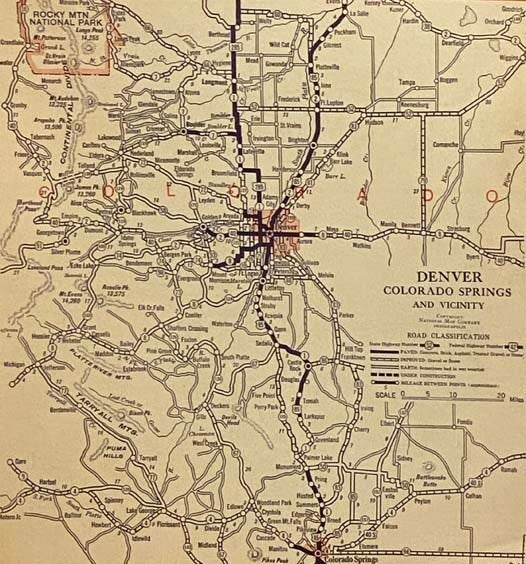
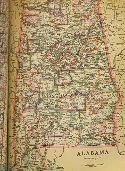
xlviii, 29-116 pp. Fabricoid cover over post-bound text block. Ten publisher coupons for ordering of revised maps bound in after text. A particularly important road atlas, in that it is among the first to include the newly numbered federal highway system -- the Bureau of Public Roads and the Federal Highway Administration teamed up to accomplish these name changes in 1925 (State Planning & Research Guide, Vol. 59, No. 4, Spring 1996). OCLC lists four different editions of this title, printed in 1928, 1929, 1931, and 1935. The first two are based on the 1920 census, the second two on the 1930 census. The 1929 edition is designated as 'Edition 1263'. Also includes two pages on national parks, an extensive index, and gazetteer.

Price: $200.00

See all items in History, Maps & Atlases
See all items by