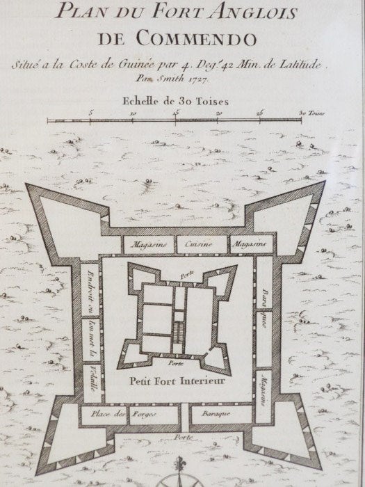
1747 Plan from Prevost's 'Histoire Generale des Voyages': Plan du Fort Anglois de Commendo, Situe a la Coste de Guinee par 4. Deg. 42 Min. de Latitude Par Smith 1727
. [A La Haye : Chez Pierre de Hondt], 1747. Print. Near Fine. Item #1665744
Matted and reading for framing. An exceptional example.
Matted to 9 1/2 x 7 (mat measures 11 5/8 x 9). Labeled Tome IV. No. 5, indicating position in the original work. French text. A birds'-eye view of the fort complete with scale and latitudinal coordinates. This fortification is designed in the more modern star shaped pattern to account for defense against artillery. It is actually two fortresses in one. The larger has bastions on each corner, and the arrangement of batteries along the walls of these indicates that defense of the south and east was deemed most critical. The walls of the outer fortress house a kitchen, magazines, barracks, forges and what seems to be a chicken coop, labeled more literally as 'Endroit ou l'on met la Volaille'. The inner fort shares the four-bastion design, and is slightly angled in comparison to the outer walls.
Price: $40.00
