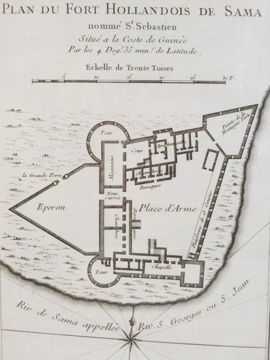
1747 Plan from Prevost's 'Histoire Generale des Voyages': Plan du Fort Hollandois de Sama nomme St Sebastien, Situe a la Coste de Guinee par les 4 Deg. 35 mins. de Latitude
. [A La Haye : Chez Pierre de Hondt], 1747. Print. Near Fine. Item #1665741
Matted and reading for framing. An exceptional example.
Matted to 9 1/2 x 7 (mat measures 11 5/8 x 9). Labeled Tome IV. No. 4, indicating position in the original work. French text. A birds'-eye view of the fort complete with scale and latitudinal coordinates. This is a fairly complex fort, comparatively, with a structure of numerous apartments and barracks, a magazine, a court and a chapel, defended by an array of three towers and two large bastions (interestingly labeled as 'Eperon' and 'Pointe de la Montagne Verte' on this plan). The fort is flanked on two sides by water, and numerous batteries for canonry line these walls, and also the north wall.
Price: $40.00
