![Item #1665541 1745 Map: Ypres a strong City and Castle in Flanders [Belgium], restor'd to the Emperor by the Treaty of Utrecht, For Mr. Tindal's Continuation of Mr. Rapin's History of England. Nicolas Tindal, Rapin De Thoyras.](https://yesterdaysmuse.cdn.bibliopolis.com/pictures/1665541.jpg?width=768&height=1000&fit=bounds&auto=webp&v=1706725768)
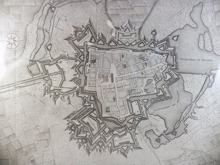
1745 Map: Ypres a strong City and Castle in Flanders [Belgium], restor'd to the Emperor by the Treaty of Utrecht, For Mr. Tindal's Continuation of Mr. Rapin's History of England
[London]: [John and Paul Knapton], 1745. Print. Very Good. Item #1665541
Matted and ready for framing. Evidence of three folds, left side trimmed.
A 1745 map with scale and compass, taken from Tindal & Rapin's History of England, which was published from 1743-1747. Ypres was an important fortress and trade location from the Middle Ages through World War I. The print depicts the star shaped fortifications typical to most fortifications of the time, which were designed to accommodate defensive canonry and defend against artillery sieges. The waterways in the map and several of the hornworks within the natural moat are labeled, and the arrangement of streets within the fortification is well demarcated.
Price: $75.00